GIS Mapping Services
Our current GIS Department’s services include – Digital map production For more information on our Mapping/GIS/GPS services, please contact our GIS Technician at njankowski@forestfloorcontracting.ca Back to Forestry Services
|
GIS Mapping Salvage Non-Replaceable Forest License Silviculture Mountain Pine Beetle Management Oil and Gas Development GPS Data Capture Electronic Data Submissions |
Company Prospectus  Home
Home 
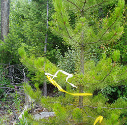 We have extensive expertise in the use of GPS equipment in the forestry industry. Since 1994, we’ve been able to accurately collect any necessary data and map it to our clients needs. From harvest boundaries, roads, riparian reatures, bridge installments, to beetle sites, we gps and map it all. Our GIS software and plotters allow us to provide our clients with accurate displays of their data in thematic or general purpose maps.